Friday, October 10, 2008

The Mayan Calendar

The Mayan Calendar

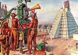
    Among their other accomplishments, the ancient Mayas invented a calendar of remarkable accuracy and complexity. At right is the ancient Mayan Pyramid Chichen Itza, Yucatan, Mexico. The Pyramid of Kukulkan at Chichén Itzá, constructed circa 1050 was built during the late Mayan period, when Toltecs from Tula became politically powerful. The pyramid was used as a calendar: four stairways, each with 91 steps and a platform at the top, making a total of 365, equivalent to the number of days in a calendar year.

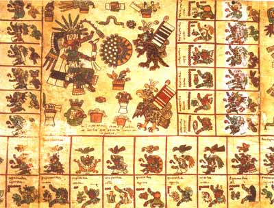
    The Maya calendar was adopted by the other Mesoamerican nations, such as the Aztecs and the Toltec, which adopted the mechanics of the calendar unaltered but changed the names of the days of the week and the months. An Aztec calendar stone is shown at right (below).

    The Maya calendar uses three different dating systems in parallel, the Long Count, the Tzolkin (divine calendar), and the Haab (civil calendar). Of these, only the Haab has a direct relationship to the length of the year.

    A typical Mayan date looks like this: 12.18.16.2.6, 3 Cimi 4 Zotz.

    12.18.16.2.6 is the Long Count date.
    3 Cimi is the Tzolkin date.
    4 Zotz is the Haab date.

What is the Long Count?

    The Long Count is really a mixed base-20/base-18 representation of a number, representing the number of days since the start of the Mayan era. It is thus akin to the Julian Day Number.

    The basic unit is the kin (day), which is the last component of the Long Count. Going from right to left the remaining components are:


    uinal (1 uinal = 20 kin = 20 days)
    tun (1 tun = 18 uinal = 360 days = approx. 1 year)
    katun (1 katun = 20 tun = 7,200 days = approx. 20 years)
    baktun (1 baktun = 20 katun = 144,000 days = approx. 394 years)

    The kin, tun, and katun are numbered from 0 to 19.
    The uinal are numbered from 0 to 17.
    The baktun are numbered from 1 to 13.

    Although they are not part of the Long Count, the Mayas had names for larger time spans. The following names are sometimes quoted, although they are not ancient Maya terms: 1 pictun = 20 baktun = 2,880,000 days = approx. 7885 years
    1 calabtun = 20 pictun = 57,600,000 days = approx. 158,000 years
    1 kinchiltun = 20 calabtun = 1,152,000,000 days = approx. 3 million years
    1 alautun = 20 kinchiltun = 23,040,000,000 days = approx. 63 million years

    The alautun is probably the longest named period in any calendar.

When did the Long Count Start?

    Logically, the first date in the Long Count should be 0.0.0.0.0, but as the baktun (the first component) are numbered from 1 to 13 rather than 0 to 12, this first date is actually written 13.0.0.0.0.

    The authorities disagree on what 13.0.0.0.0 corresponds to in our calendar. I have come across three possible equivalences:

    13.0.0.0.0 = 8 Sep 3114 BC (Julian) = 13 Aug 3114 BC (Gregorian)
    13.0.0.0.0 = 6 Sep 3114 BC (Julian) = 11 Aug 3114 BC (Gregorian)
    13.0.0.0.0 = 11 Nov 3374 BC (Julian) = 15 Oct 3374 BC (Gregorian)

    Assuming one of the first two equivalences, the Long Count will again reach 13.0.0.0.0 on 21 or 23 December AD 2012 - a not too distant future.

    The date 13.0.0.0.0 may have been the Mayas' idea of the date of the creation of the world.

What is the Tzolkin?

    The Tzolkin date is a combination of two "week" lengths.

    While our calendar uses a single week of seven days, the Mayan calendar used two different lengths of week:

    • a numbered week of 13 days, in which the days were numbered from 1 to 13
    • a named week of 20 days, in which the names of the days were:

    0. Ahau 1. Imix 2. Ik 3. Akbal 4. Kan
    5. Chicchan 6. Cimi 7. Manik 8. Lamat 9. Muluc
    10. Oc 11. Chuen 12. Eb 13. Ben 14. Ix
    15. Men 16. Cib 17. Caban 18. Etznab 19. Caunac

    The diagram at right shows the day symbols, in the same order as the table above.

    As the named week is 20 days and the smallest Long Count digit is 20 days, there is synchrony between the two; if, for example, the last digit of today's Long Count is 0, today must be Ahau; if it is 6, it must be Cimi. Since the numbered and the named week were both "weeks," each of their name/number change daily; therefore, the day after 3 Cimi is not 4 Cimi, but 4 Manik, and the day after that, 5 Lamat. The next time Cimi rolls around, 20 days later, it will be 10 Cimi instead of 3 Cimi. The next 3 Cimi will not occur until 260 (or 13 x 20) days have passed. This 260-day cycle also had good-luck or bad-luck associations connected with each day, and for this reason, it became known as the "divinatory year."

    The "years" of the Tzolkin calendar are not counted.

When did the Tzolkin Start?

    Long Count 13.0.0.0.0 corresponds to 4 Ahau. The authorities agree on this.

What is the Haab?

    The Haab was the civil calendar of the Mayas. It consisted of 18 "months" of 20 days each, followed by 5 extra days, known as Uayeb. This gives a year length of 365 days.

    The names of the month were:


    1. Pop 7. Yaxkin 13. Mac
    2. Uo 8. Mol 14. Kankin
    3. Zip 9. Chen 15. Muan
    4. Zotz 10. Yax 16. Pax
    5. Tzec 11. Zac 17. Kayab
    6. Xul 12. Ceh 18. Cumku

    In contrast to the Tzolkin dates, the Haab month names changed every 20 days instead of daily; so the day after 4 Zotz would be 5 Zotz, followed by 6 Zotz ... up to 19 Zotz, which is followed by 0 Tzec.

    The days of the month were numbered from 0 to 19. This use of a 0th day of the month in a civil calendar is unique to the Maya system; it is believed that the Mayas discovered the number zero, and the uses to which it could be put, centuries before it was discovered in Europe or Asia.

    The Uayeb days acquired a very derogatory reputation for bad luck; known as "days without names" or "days without souls," and were observed as days of prayer and mourning. Fires were extinguished and the population refrained from eating hot food. Anyone born on those days was "doomed to a miserable life."

    The years of the Haab calendar are not counted.

    The length of the Tzolkin year was 260 days and the length of the Haab year was 365 days. The smallest number that can be divided evenly by 260 and 365 is 18,980, or 365×52; this was known as the Calendar Round. If a day is, for example, "4 Ahau 8 Cumku," the next day falling on "4 Ahau 8 Cumku" would be 18,980 days or about 52 years later. Among the Aztec, the end of a Calendar Round was a time of public panic as it was thought the world might be coming to an end. When the Pleaides crossed the horizon on 4 Ahau 8 Cumku, they knew the world had been granted another 52-year extension.

When did the Haab Start?

    Long Count 13.0.0.0.0 corresponds to 8 Cumku. The authorities agree on this.

Did the Mayas Think a Year Was 365 Days?

    Although there were only 365 days in the Haab year, the Mayas were aware that a year is slightly longer than 365 days, and in fact, many of the month-names are associated with the seasons; Yaxkin, for example, means "new or strong sun" and, at the beginning of the Long Count, 1 Yaxkin was the day after the winter solstice, when the sun starts to shine for a longer period of time and higher in the sky. When the Long Count was put into motion, it was started at 7.13.0.0.0, and 0 Yaxkin corresponded with Midwinter Day, as it did at 13.0.0.0.0 back in 3114 B.C.E. The available evidence indicates that the Mayas estimated that a 365-day year precessed through all the seasons twice in 7.13.0.0.0 or 1,101,600 days.

    We can therefore derive a value for the Mayan estimate of the year by dividing 1,101,600 by 365, subtracting 2, and taking that number and dividing 1,101,600 by the result, which gives us an answer of 365.242036 days, which is slightly more accurate than the 365.2425 days of the Gregorian calendar.

    (This apparent accuracy could, however, be a simple coincidence. The Mayas estimated that a 365-day year precessed through all the seasons twice in 7.13.0.0.0 days. These numbers are only accurate to 2-3 digits. Suppose the 7.13.0.0.0 days had corresponded to 2.001 cycles rather than 2 cycles of the 365-day year, would the Mayas have noticed?)

    In ancient times, the Mayans had a tradition of a 360-day year. But by the 4th century B.C.E. they took a different approach than either Europeans or Asians. They maintained three different calendars at the same time. In one of them, they divided a 365-day year into eighteen 20-day months followed by a five-day period that was part of no month. The five-day period was considered to be unlucky.

World's Longest Underground River

World's Longest Underground River Discovered in Mexico


National Geographic - March 6, 2007

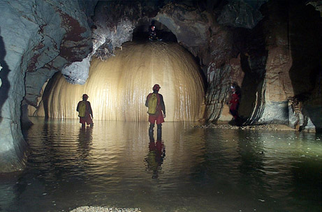
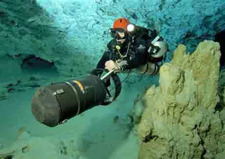
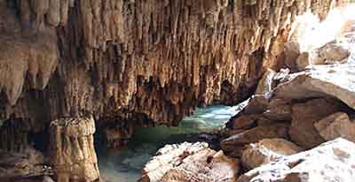
    Divers exploring a maze of underwater caves on Mexico's Yucatán Peninsula have identified what may be the longest underground river in the world. The waterway twists and turns for 95 miles (153 kilometers) through the region's limestone caverns, said British diver Stephen Bogaerts, who made the discovery with German colleague Robbie Schmittner. In a straight line, the system would span about six miles (ten kilometers) of land. (Related: [February 27, 2007].)

    Bogaerts and Schmittner spent four years exploring using underwater scooters and specially rigged gas cylinders to find a connection between the Yucatán region's second and third longest cave systems, known respectively as Sac Actun and Nohoch Nah Chich ( The team scoured the passages, marking each new twist and turn with carefully labeled rope. On January 23 the pair headed toward the final connection from opposite sides and used an unopened bottle of champagne to make the final tie-off between the two systems. The pair celebrated with a second bottle of champagne on the surface. Long a popular retreat for beachgoers, the Yucatán Peninsula has become a favorite destination for cave divers, Melton added. "Just about any time you go you can nearly always go find a new place to explore," Melton said.

    He likens the region to "a huge limestone sponge." That's because the peninsula is largely made of limestone, a soft and porous rock that is easily eroded by slightly acidic rainwater, which carves out underground passages as it courses toward the Caribbean Sea. The pathways range from jumbo-jet-size rooms with long stalagmites and stalactites to narrow slits that divers must blindly squeeze through.

    The passages are completely flooded with water that stays a constant 76 degrees Fahrenheit (25 degrees Celsius) year-round. The water itself is layered: A lens of freshwater rests on top of salt water. When fresh rainwater percolates down, the liquid flows out horizontally and is discharged into the ocean. Divers access the caves through sinkholes called cenotes, which lay scattered throughout the peninsula under the rain forest canopy. "But the water isn't just flowing through these underground rivers ... 98 percent of the water is actually trapped in the rock," Bogaerts, the diver, said.

    The Yucatán's natural hydraulic system sustained the Maya for centuries and today is the main freshwater source for the region's booming tourism trade. But the cave diving community is concerned that the rapid pace of development could stress the supply. "These cave systems are so extensive and so interconnected that if there is a point of pollution in one area then it can quickly get distributed to a very, very wide area," Bogaerts said. (Related: [April 19, 2006].)

Mexico: Divers discover huge underground river Guardian - March 1, 2007

Mexico's Yucatan Peninsula: Longest underground river foundReuters - March 1, 2007

    Cave divers in Mexico's Yucatan peninsula have discovered what may be the world's longest underground river, connecting two cave systems with a waterway at least 95 miles long. A group of foreign divers exploring the area near the Caribbean beach resort of Playa del Carmen have yet to name the stretch, but believe it could be connected to two other major systems, adding more than 125 miles to its length. "It's a bit of the Star Trek syndrome: the thrill of exploration, to go where no one has gone before," said diver Steve Bogaerts, who helped find the underground river. Prior to the discovery, the Palawan underground river in the Philippines and Vietnam's Son Trach River vied for the record as the world's longest. The area in southeast Mexico is home to tourist resorts Cancun and Cozumel, as well as Mayan ruins Chichen Itza and Tulum. It sits on a Swiss-cheese subsoil of limestone dotted with deep wells that are entrances to tunnels.


Mayan Writing - Cod

Mayan Writing - Codices

The Mayans evolved the only true written system native to the Americas and were masters of mathematics and engineering.

The Maya writing system (often called hieroglyphics from a vague superficial resemblance to the Egyptian writing, to which it is not related) was a combination of phonetic symbols and ideograms. It is the only writing system of the Pre-Columbian New World that can completely represent spoken language to the same degree as the written language of the old world. The decipherment of the Maya writings has been a long laborous process. Bits of it were first deciphered in the late 19th and early 20th century (mostly the parts having to do with numbers, the calendar, and astronomy), but major breakthroughs came starting in the 1960s and 1970s and accelerated rapidly thereafter, so that now the majority of Maya texts can be read nearly completely in their original languages.

With the decipherment of the Maya script it was discovered that the Maya were one of the few civilizations where artists attached their name to their work. The Maya developed a highly complex system of writing, using pictographs and phonetic or syllabic elements. Their writing was highly sophisticated. Most likely only members of the higher classes were able to read their symbols.

Maya writing was composed of recorded inscriptions on stone and wood and used within architecture. Rectangular lumps of plaster and paint chips are a frequent discovery in Maya archaeology; they are the remains of what had been books after all the organic material has decayed.

Folding tree books were made from fig tree bark and placed in royal tombs. Unfortunately, many of these books did not survive the humidity of the tropics or the invasion of the Spanish, who regarded the symbolic writing as the work of the devil.

The Maya also carved these symbols into stone, but the most common place for writing was probably the highly perishable books they made from bark paper, coated with lime to make a fresh white surface. These 'books' were screen-folded and bound with wood and deer hide. They are called codices; codex is singular.

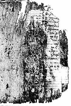
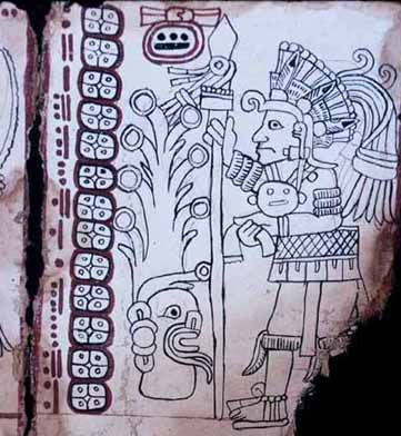
Unfortunately zealous Spanish priests shortly after the conquest ordered the burning of all the Maya books. While many stone inscriptions survive - mostly from cities already abandoned when the Spanish arrived - only 3 books and a few pages of a fourth survive from the ancient libraries. Only four codices remain today.

The Dresden Codex - Astronomy

The Madrid Codex

The Paris Codex

The Grolier Codex

The contents of the codices must have varied, but some of them were evidently similar to astronomic almanacs. We have examples of a Venus table, eclipse tables in a codex in Dresden. There is a codex in Paris that seems to contain some kind of Maya Zodiac, but if it is and how it must have worked are still unknown.

Another major example of Maya almanacs are present in the Madrid Codex. The fourth codex is called the Grolier and was authenticated as late as 1983. These codices probably contained much of the information used by priests or the noble class to determine dates of importance or seasonal interest. We can only speculate as to whether or not the Maya developed poetry or drama that was committed to paper. The codices probably kept track of dynastic information as well.

Mayans had a voluminous literature, covering the whole range of native interests either written, in their own peculiar "calculiform" hieroglyphic characters, in books of maguey paper or parchment which were bound in word, or carved upon the walls of their public buildings.

Twenty-seven parchment books were publicly destroyed by Bishop Landa at Mani in 1562, others elsewhere in the peninsula, others again at the storming of the Itzá capital in 1697, and almost all that have come down to us are four codices, as they are called, viz., the "Codex Troano", published at Paris in 1869; another codex apparently connected with the first published at Paris in 1882; the "Codex Peresianus", published at Paris in 1869-71; and the "Dresden Codex", originally mistakenly published as an Aztec book in Kingsborough's great work on the "Antiquities of Mexico" (London, 1830-48).

Besides these pre-Spanish writings, of which there is yet no adequate interpretation, we have a number of later works written in the native language by Christianized Maya, shortly after the conquest.

Several of these have been brought together by Brinton in his "Maya Chronicles". The intricate calendar system of the Maya, which exceeded in elaboration that of the Aztec, Zapotec, or any other of the cultured native races, has been the subject of much discussion.

It was based on a series of katuns, or cycles, consisting of 20 (or 24), 52, and 260 years, and by its means they carried their history down for possibly thirteen centuries, the completion of each lesser katun being noted by the insertion of a memorial stone in the wall of the great temple at Mayapan.


Maya Civilization art

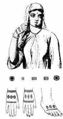
Tattooing is one of the oldest art forms on the planet, dating to prehistoric times and cave dwellers who often created tattooes as part of ritual practices linked to shamanism, protection, connection with their gods, and embuing them with magica powers. Early tattooing was used to symbolize the fertility of the earth and of womankind, preservation of life after death, the sacredness of chieftainship and other cultural factors.

Tattooed markings on skin and incised markings in clay provide some of the earliest evidence that humans have long practiced a wide range of body art. The written accounts of early European explorers also attest to the elaborate and widespread nature of tattooing in various parts of the world, providing an insight into traditions that had their origins deep in the past.

Marriage tattoos have been particularly popular to insure that you can find your lawful spouse or spouses in the afterlife, even if you have passed 'through the veil,' many years apart. Ancient Ainu marriage rites state that a woman who marries without first being tattooed, in the proper manner, commits a great sin and when she dies; she will go straight to God.

Tattooing as a rite of adulthood, or passage into puberty, was another common tattoo ritual. If a girl can't take the pain of tattooing, she is un-marriageable, because she will never be able to deal with the pain of child birth. If a boy cannot deal with the pain of his puberty tattoos, he is considered to be a bad risk as a warrior, and could become an outcast.

Since the dawn of tattooing, people have been marking themselves with the signs of their totem animals. On the outer level of meaning, they are trying to gain the strengths and abilities of the totem animal. On a more inner and mystical level, totem animals mean that the bearer has a close and mysterious relationship with this animal spirit as his guardian. Totem animal tattoos often double as clan or group markings. Modern dragon, tiger, and eagle tattoos often subconsciously fall into this category. My snake tattoos are examples of DNA and the human biogenetic experiment.

Another common practice was tattooing for health wherein the tattooing of a god was placed on the afflicted person, to fight the illness for them. An offshoot of tattooing for health is tattooing to preserve youth. Maori girls tattooed their lips and chin, for this reason. When an old Ainu lady's eyesight is failing, she can re-tattoo her mouth and hands, for better vision. This is still practiced today.

Tattoos for general good luck are found world-wide. A man in Burma who desires good luck will tattoo a parrot on his shoulder. In Thailand, a scroll representing Buddha in an attitude of meditation is considered a charm for good luck. In this charm, a right handed scroll is masculine and a left handed scroll is feminine. Today, in the West, you can see dice, spades, and Lady Luck tattoos, which are worn to bring luck.


History


Prehistoric Times


Archaeologists find 2,500-year-old mummy in Mongolia, tattoos, blond hair and a felt hat
PhysOrg - August 25, 2006

Tattooing has been a Eurasian practice since Neolithic times."Otzi the Iceman",dated circa 3300 BC, exhibits possible therapeutic tattoos (small parallel dashes along lumbar and on the legs). Tarim Basin (West China, Xinjiang) revealed several tattooed mummies of a Western (Western Asian/European) physical type. Still relatively unknown (the only current publications in Western languages are those of J P. Mallory and V H. Mair, The Tarim Mummies, London, 2000), some of them could date from the end of the 2nd millennium BCE.

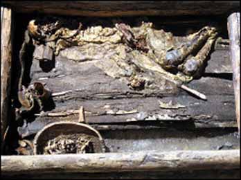
The world's most spectacular tattooed mummy was discovered by Russian anthropologist Sergei Ivanovich Rudenko in 1948 during the excavation of a group of Pazyryk tombs about 120 miles of the border between China and Russia.

These mummies were found in the High Altai Mountains of western and southern Siberia and date from around 2400 years ago. The tattoos on their bodies represent a variety of animals. The griffins and monsters are thought to have a magical significance but some elements are believed to be purely decorative. Altogether the tattoos are believed to reflect the status of the individual.

Three tattooed mummies (c. 300 BCE) were extracted from the permafrost of Altaï in the second half of the 20th century (the Man of Payzyrk, during the 1940s; one female mummy and one male in Ukok plateau, during the 1990s). Their tattooing involved animal designs carried out in a curvilinear style.


The Man of Pazyryk was also tattooed with dots that lined up along
the spinal column (lumbar region) and around the right ankle.


Pazyryk Mummies - Pazyryk Culture

The Pazyryks were formidable iron age horsemen and warriors who inhabited the steppes of Eastern Europe and Western Asia from the sixth through the second centuries BC. They left no written records, but Pazyryk artifacts are distinguished by a sophisticated level of artistry and craftsmanship. The Pazyryk tombs discovered by Rudenko were in an almost perfect state of preservation. They contained skeletons and intact bodies of horses and embalmed humans, together with a wealth of artifacts including saddles, riding gear, a carriage, rugs, clothing, jewelry, musical instruments, amulets, tools, and, interestingly, hash pipes, described by Rudenko as "apparatus for inhaling hemp smoke".

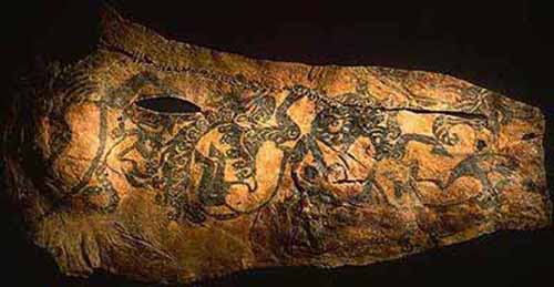
Also found in the tombs were fabrics from Persia and China, which the Pazyryks must have obtained on journeys covering thousands of miles. Rudenko's most remarkable discovery was the body of a tattooed Pazyryk chief: a thick-set, powerfully built man who had died when he was about 50. Parts of the body had deteriorated, but much of the tattooing was still clearly visible. The chief was elaborately decorated with an interlocking series of designs representing a variety of fantastic beasts.

The best preserved tattoos were images of a donkey, a mountain ram, two highly stylized deer with long antlers and an imaginary carnivore on the right arm. Two monsters resembling griffins decorate the chest, and on the left arm are three partially obliterated images which seem to represent two deer and a mountain goat.

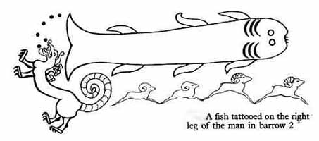
On the front of the right leg a fish extends from the foot to the knee. A monster crawls over the right foot, and on the inside of the shin is a series of four running rams which touch each other to form a single design. The left leg also bears tattoos, but these designs could not be clearly distinguished. In addition, the chief's back is tattooed with a series of small circles in line with the vertebral column. This tattooing was probably done for therapeutic reasons. Contemporary Siberian tribesmen still practice tattooing of this kind to relieve back pain.

No instruments specifically designed for tattooing were found, but the Pazyryks had extremely fine needles with which they did miniature embroidery, and these were undoubtedly used for tattooing In the summer of 1993 another tattooed Pazyryk mummy was discovered in Siberia's Umok plateau. It had been buried over 2,400 years ago in a casket fashioned from the hollowed-out trunk of a larch tree. On the outside of the casket were stylized images of deer and snow leopards carved in leather. Shortly after burial the grave had apparently been flooded by freezing rain and the entire contents of the burial chamber had remained frozen in permafrost.

The body was that of a young woman whose arms had been tattooed with designs representing mythical creatures like those on the previously discovered Pazyryk mummy. She was clad in a voluminous white silk dress, a long crimson woolen skirt and white felt stockings.

On her head was an elaborate headdress made of hair and felt - the first of its kind ever found intact. Also discovered in the burial chamber were gilded ornaments, dishes, a brush, a pot containing marijuana, and a hand mirror of polished metal on the wooden back of which was a carving of a deer. Six horses wearing elaborate harnesses had been sacrificed and lay on the logs which formed the roof of the burial chamber.

Considering the number of tattooed mummies which have been discovered, it is apparent that tattooing was widely practiced throughout the ancient world and was associated with a high level of artistic endeavor. The imagery of ancient tattooing is in many ways similar to that of modern tattooing.

All of the known Pazyryk tattoos are images of animals. Animals are the most frequent subject matter of tattooing in many cultures and are traditionally associated with magic, totemism, and the desire of the tattooed person to become identified with the spirit of the animal. Tattoos which have survived on mummies suggest that tattooing in prehistoric times had much in common with modern tattooing, and that tattooing the world over has profound and universal psychic origins.


Tattooing in japan (Jomon Period)

Tattooing for spiritual and decorative purposes in Japan is thought to extend back to at least the Jomon or paleolithic period (approximately 10,000 BCE) and was widespread during various periods for both the Japanese and the native ainu Chinese visitors observed and remarked on the tattoos in Japan (300 BCE).

In Japanese the word used for traditional designs or those that are applied using traditional methods is irezumi ("insertion of ink"), while "tattoo" is used for non-Japanese designs. The earliest evidence of tattooing in Japan comes from figurines called dogu. Most of these date to 3000 years ago and display similar markings to the tattooed mouths found among the women of the Ainu (the Indigenous people of Japan).

Tattoo enthusiasts may refer to tattoos as tats, ink, art or work, and to tattooists as artists. The latter usage is gaining support, with mainstream art galleries holding exhibitions of tattoo designs and photographs of tattoos. Tattoo designs that are mass-produced and sold to tattoo artists and studios and displayed in shop are known as flash.


china

Tattooing has also been featured prominently in one of the Four Classic Novels in Chinese literature, Water Margin, in which at least three of the 108 characters, Lu Zhi Chen, Shi Jin, and Yan Chen are described as having tattoos covering nearly the whole of their bodies. In addition, Chinese legend has it that the mother of Yue Fei, the most famous general of the Song Dynasty, tattooed the words jin zhong bao guo on his back with her sewing needle before he left to join the army, reminding him to "repay his country with pure loyalty".


Egypt

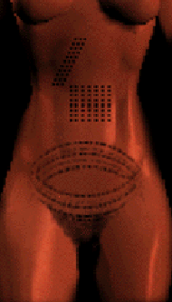
Tattooing has actually been practiced since the time of the ancient Egyptians and is common throughout the world. In 1891, archaeologists discovered the mummified remains of Amunet- Dynasty XI, Egypt, c. 4040 - 3994 years ago. This mummy was found at Thebes. Amunet (various spellings) was a priestess of Hathor This female mummy displayed several lines and dots and dashes tattooed on her body, aligned in abstract geometrical patterns.

These dot-and-dash patterns have been seen for many years throughout Egypt. This pattern and skill of tattoo may have been borrowed from the Nubians. The art of tattoo developed during the Middle Kingdom and flourished beyond. The evidence to date suggests that this art form was restricted to women only, and usually these women were associated with ritualistic practice. These mummies give us site into how long this art form has been practiced and how their art was displayed. From continent to continent this art form has developed and transformed. Through the Egyptian eyes to other cultures, tattoo is something that satisfies various needs and interest.

A second mummy also found depicted this same type of line pattern (the dancer). This mummy also had a cicatrix pattern over her lower pubic region. In the figure to the right you can see the various patterns as they are displayed on the body. The various design patterns also appeared on several figurines that date to the Middle Kingdom, these figurines have been labeled the "Brides of Death." The figurines are also associates with the goddess Hathor. All tattooed Egyptian mummies found to date are female. The location of the tattoos on the lower abdomen are thought to be linked to fertility.

Egyptian tattooing was someitmes related to the sensual, erotic, and emotional side of life, and all these themes are found in tattooing today.


Egypt 1800's


Middle East

An archaic practice in the Middle East involved people cutting themselves and rubbing in ash during a period of mourning after an individual had died. It was a sign of respect for the dead and a symbol of reverence and a sense of the profound loss for the newly departed; and it is surmised that the ash that was rubbed into the self-inflicted wounds came from the actual funeral pyres that were used to cremate bodies. In essence, people were literally carrying with them a reminder of the recently deceased in the form of tattoos created by ash being rubbed into shallow wounds cut or slashed into the body, usually the forearms.


Australia


Early Aussie Tattoos Match Rock Art Discovery - June 2, 2008

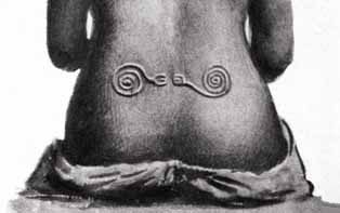
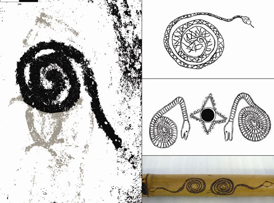
Body art was all the rage in early Australia, as it was in many other parts of the ancient world, and now a new study reports that elaborate and distinctive designs on the skin of indigenous Aussies repeated characters and motifs found on rock art and all sorts of portable objects, ranging from toys to pipes. The study not only illustrates the link between body art, such as tattoos and intentional scarring, with cultural identity, but it also suggests that study of this imagery may help to unravel mysteries about where certain groups traveled in the past, what their values and rituals were, and how they related to other cultures.

"Distinctive design conventions can be considered markers of social interaction so, in a way (they are) a cultural signature of sorts that archaeologists can use to understand ways people were interacting in the past," author Liam Brady of Monash University's Center for Australian Indigenous Studies, told Discovery News.

For the study, published in the latest issue of the journal Antiquity, Brady documented rock art drawings; images found on early turtle shell, stone and wood objects, such as bamboo tobacco pipes and drums; and images that were etched onto the human body through a process called scarification. "In a way, a scarred design could be interpreted as a tattoo," Brady said. "It was definitely a distinctive form of body ornamentation and it was permanent since the design was cut into the skin. Evidence for scarification is primarily via (19th century) anthropologists -- mainly A.C. Haddon -- who took black and white photographs of some designs, as well as drawing others into his notebooks in the late 1800's," he added.

Both Haddon and Brady focused their attention on a region called the Torres Strait. This is a collection of islands in tropical far northeastern Queensland. The islands lie between Australia and the Melanesian island of New Guinea. Although people were living in the Torres Strait as early as 9,000 years ago, when sea levels were lower and a land bridge connected Australia with New Guinea, archaeological exploration of the area only really began with Haddon's 19th century work. Since body art, rock art, wooden objects and other tangible items have a relatively short shelf life, Haddon's collections and data represent some of the earliest confirmed findings for the region.

Brady determined that within the body art, rock art and objects, four primary motifs often repeated: a fish headdress, a snake, a four-pointed star, and triangle variants. The fish headdress, usually made of a turtle shell decorated with feathers and rattles, was worn during ceremonies and has, in at least one instance, been linked to a "cult of the dead." The triangular designs, on the other hand, were often scarred onto women's skin and likely indicated these individuals were in mourning. Analysis of the materials found that two basic groups -- horticulturalists and hunter-gatherers -- inhabited the Torres Strait during its early history. Aboriginal people at Cape York, a peninsula close to Australia, had "a different artistic system in operation, which did not incorporate many designs from Papua New Guinea," Brady said.

Based on land locations where the body art and object imagery were found, as well as the nature of the designs, Brady concludes that the Cape York residents were the hunter-gatherers, while groups in more northerly locations within Torres Strait appear to have been horticulturalists. Since imagery mixed and matched more among the early farmers, Brady concludes they enjoyed kinship links, and engaged in extensive trade, with Papua New Guinea groups. In the future, similar studies could help to identify cultural groups in other regions, while also revealing their social interactions. Such studies could prove particularly useful for other parts of Australia and New Zealand, where tattooing and body art, as well as totems -- protection entities often depicted with colorful imagery -- were common.

Recently, for example, the Field Museum in Chicago returned the human remains of 14 Maori native New Zealanders back to their country of origin. The remains are now at the Museum of New Zealand Te Papa. Included in the collection of mandibles, crania and other bones is "one preserved head with facial tattoos," according to a Field Museum announcement. In an act of repatriation, nine tattooed Maori heads were also recently gifted to Te Papa by Scotland's Aberdeen Museum. Te Taru White, a Maori specialist at Te Papa, said the "ancestors" made "the long journey home to New Zealand and to their people." The heads are now in a consecrated, sacred space within the New Zealand museum, where they may be studied and researched further. In Brady's case, his work was undertaken as part of collaborative research projects initiated by certain Torres Strait and Aboriginal communities.


Tattooing in the South Pacific

The term "tattoo" is traced to the Tahitian tatu or tatau, meaning to mark or strike, the latter referring to traditional methods of applying the designs.

The earliest evidence of tattooing in the Pacific is in the form of this pottery shard which is approximately 3000 years old. The Lapita face shows dentate (pricked) markings on the nose, cheeks and forehead, suggestive of the technique of tattoo application.

Unique tattooed face depicted in 3 dimensions on a Lapita

pottery sherd was recently found on Boduna Island.


Painted Past: Borneo's Traditional Tattoos
National Geographic - June 18, 2004


Maori of New Zealand

Between 1766 and 1779, Captain James Cook made three voyages to the South Pacific, the last trip ending with Cook's death in Hawaii in February, 1779. When Cook and his men returned home to Europe from their voyages to Polynesia, they told tales of the 'tattooed savages' they had seen.

Cook's Science Officer and Expedition Botanist, Sir Joseph Banks, returned to England with a tattoo. Banks was a highly regarded member of the English aristocracy and had acquired his position with Cook by putting up what was at the time the princely sum of some ten thousand pounds in the expedition. In turn, Cook brought back with him a tattooed Tahitian chief, whom he presented to King George and the English Court. Many of Cook's men, ordinary seamen and sailors, came back with tattoos, a tradition that would soon become associated with men of the sea in the public's mind and the press of the day. In the process sailors and seamen re-introduced the practice of tattooing in Europe and it spread rapidly to seaports around the globe.

It was in Tahiti aboard the Endeavour, in July of 1769, that Cook first noted his observations about the indigenous body modification and is the first recorded use of the word tattoo. In the Ship's Log, Cook recorded this entry: "Both sexes paint their bodies, "Tattow," as it is called in their Language. This is done by inlaying the colour of black under their skins, in such a manner as to be indelible. This method of Tattowing is a painful operation, especially the Tattowing of their buttocks. It is performed but once in their lifetimes.

The Concept of Tattooing Spreads

The British Royal Court must have been fascinated with the Tahitian chief's tattoos, because the future King George V had himself inked with the 'Cross of Jerusalem' when he traveled to the Middle East in 1892. He also received a dragon on the forearm from the needles of an acclaimed tattoo master during a visit to Japan. George's sons, The Duke of Clarence and The Duke of York were also tattooed in Japan while serving in the British Admiralty, solidifying what would become a family tradition.

Taking their sartorial lead from the British Court, where Edward VII followed George V's lead in getting tattooed; King Frederick IX of Denmark, the King of Romania, Kaiser Wilhelm II, King Alexander of Yugoslavia and even Tsar Nicholas II of Russia, all sported tattoos, many of them elaborate and ornate renditions of the Royal Coat of Arms or the Royal Family Crest. King Alfonso of modern Spain also had a tattoo.

Tattooing spread among the upper classes all over Europe in the nineteenth century, but particularly in Britain where it was estimated in Harmsworth Magazine in 1898 that as many as one in five members of the gentry were tattooed. There, it was not uncommon for members of the social elite to gather in the drawing rooms and libraries of the great country estate homes after dinner and partially disrobe in order to show off their tattoos. Aside from her consort Prince Albert, there are persistent rumours that Queen Victoria had a small tattoo in an undisclosed 'intimate' location; Denmark's king Frederick was filmed showing his tattoos taken as a young sailor. Winston Churchill's mother, Lady Randolph Churchill, not only had a tattoo of a snake around her wrist, which she covered when the need arose with a specially crafted diamond bracelet, but had her nipples pierced as well. Carrying on the family tradition, Winston Churchill was himself tattooed. In most western countries tattooing remains a subculture identifier, and is usually performed on less-often exposed parts of the body.

Pre-Christian caltic and other central and northern European tribes were often heavily tattooed, according to surviving accounts. The pictures were famously tattooed (or scarified) with elaborate dark blue woad (or possibly copper for the blue tone) designs. Julius Caesar described these tattoos in Book V of his Gallic Wars (54 BCE).

Ahmad ibn Fadlan also wrote of his encounter with the Scandinavian Rus' tribe in the early 10th century, describing them as tattooed from "fingernails to neck" with dark blue "tree patterns" and other "figures."

During the gradual process of Christianization in Europe, tattoos were often considered remaining elements of paganism and generally legally prohibited. According to Robert Graves in his book The Greek Myths tattooing was common amongst certain religious groups in the ancient Mediterranean world, which may have contributed to the prohibition of tattooing in Leviticus.

The Greek learned tattooing from the Persians. Tattooing is mentioned in accounts by Plato, Aristophanes, Julius Caesar and Herodotus. Tattoos were generally used to mark slaves and punish criminals.

The Romans tattooing from the Greeks. In the 4th century, the first Christian emperor of Rome banned the facial tattooing of slaves and prisoners. In 787, Pope Hadrian prohibited all forms of tattooing.

In the 18th century, many French sailors returning from voyages in the South Pacific had been elaborately tattooed. In 1861, French naval surgeon, Maurice Berchon, published a study on the medical complications of tattooing. After this, the Navy and Army banned tattooing within their ranks.

The ancient Celts didn't have much in the way of written record keeping, consequently, there is little evidence of their tattooing remaining. Most modern Celtic designs are taken from the Irish Illuminated Manuscripts, of the 6th and 7th centuries. This is a much later time period than the height of Celtic tattooing. Designs from ancient stone and metal work are more likely to be from the same time period as Celtic tattooing.

In England, tattooing flourished in the 19th century and became something of a tradition in the British Navy. In 1862, the Prince of Wales received his first tattoo - a Jerusalem cross - after visiting the Holy Land. In 1882, his sons, the Duke of Clarence and the Duke of York (later King George V) were tattooed by the Japanese master tattooist, Hori Chiyo.


Tattooing in Central and South America

In Peru, tattooed Inca mummies dating to the 11th century have been found. Inca tattooing is characterized by bold abstract patterns which resemble contemporary tribal tattoo designs.

In Mexico and Central America, 16th century Spanish accounts of Mayan tattooing reveal tattoos to be a sign of courage. When Cortez and his conquistadors arrived on the coast of Mexico in 1519 they were horrified to discover that the natives not only worshipped devils in the form of statues and idols, but had somehow managed to imprint indelible images of these idols on their skin. The Spaniards, who had never heard of tattooing, recognized it at once as the work of Satan. As far as we know, only one Spaniard was ever tattooed by the Mayas. His name was Gonzalo Guerrero, and he is mentioned in several early histories of Mexico.


Tattooing in North America

In North America, early Jesuit accounts testify to the widespread practice of tattooing among Native Americans. Among the Chickasaw, outstanding warriors were recognized by their tattoos. Among the Ontario Iroquoians, elaborate tattoos reflected high status.

When Europeans first arived in the New World, they found Native Americans had a rich and ancient tattooing tradition. Capt. John Smith, of Virginia, mentioned Native American tattoos in his writing in the 1600's. Most tribes celebrated adulthood with tattoo puberty rites. Simple lines and geometric patterns were used and women often had lines extending from the lower lip onto the chin. Arapaho men tattooed three dots on their own chest, to prove their manhood. The Sioux among other tribes, believed that tattoos were necessary as a rite de passage into the spirit world. As a ghost warrior rode towards the "Many Lodges", he would encounter an old woman, who would demand to see his tattoos. If he had none to show, he and his horse were pushed off the path, and fell to earth, where they became aimlessly wandering spirits, who were eternally unsatisified. With the coming of Christianity, Native American tattooing disappeared and stories changed, until we only hear of the body painting of the American Indians.

In north-west America, women's chins were tattooed to indicate marital status and group identity.

Tattooing is probably the most popular form of body adornment in America today. The designs can be small and discreet or large and obvious. Many people prefer discreet designs that can be concealed for certain occasions.


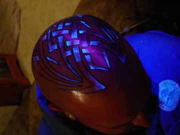
Blacklight Tattoos (Image Gallery) - August 16, 2006


Religious Prohibitions

Jewish Positions

Orthodox Jews, in strict application of Halakha (Jewish Law), believe Leviticus 19:28 prohibits getting tattoos: Do not make gashes in your skin for the dead. Do not make any marks on your skin. I am God. One reading of Leviticus is to apply it only to the specific ancient practice of rubbing the ashes of the dead into wounds; but modern tattooing is included in other religious interpretations. Orthodox/Traditional Jews also point to Shulhan Arukh, Yoreh De'ah 180:1, that elucidates the biblical passage above as a prohibition against markings beyond the ancient practice, including tattoos. Maimonides concluded that regardless of intent, the act of tattooing is prohibited (Mishneh Torah, Laws of Idolatry 12:11).

Conservative Jews point to the next verse of the Shulhan Arukh (Yoreh De'ah 180:2), "If it [the tattoo] was done in the flesh of another, the one to whom it was done is blameless" ­ this is used by they to say that tattooing yourself is different from obtaining a tattoo, and that the latter may be acceptable. Orthodox Jews disagree, but forced tatooing (like forced conversion) - as was the case during the Holocaust - is not considered a violation of Jewish Law. In another vein, cutting into the skin to perform surgery and temporary tattooing used for surgical purposes (eg: to mark the lines of an incision) are permitted in the Shulhan Arukh 180:3.

In most sectors of the religious Jewish community, having a tattoo does not prohibit participation, and one may be buried in a Jewish cemetery and participate fully in all synagogue ritual. In stricter sectors of the community, however, a community may have a psak (ruling or responsa with the weight of Halakha) that may forbid one's burial in a cemetary that comes under that ruling. Many of these communities, most notably the Modern Orthodox, accept laser removal of the tattoo as teshuvah (repentence), even when it is removed post-mortem.

Christian Positions

Some Christians believe that Leviticus 19:28 also applies to them, while others who disapprove of tattoos as a social phenomenon may rely on other scriptural arguments to make their point. Christians who believe that the religious doctrines of the Old Testament are superseded by the New Testament may still find explicit or implicit directives against tattooing in Christian scripture, in ecclesiastical law, or in church-originated social policy.The anti-tattooing position is not universal, however. The Christian Copts used tattoos as protective amulets.

Muslim Perspective

Following the Sharia (or Islamic Law), the majority of Muslims hold that tattooing is religiously forbidden (along with most other forms of 'permanent' physical modification). This view arises from Qur'anic verses and explicit references in the Prophetic Hadith which denounce those who attempt to change the creation of Allah, in what is seen as excessive attempts to beautify that which was already perfected. The human being is seen as having been ennobled by Allah, the human form viewed as created beautiful, such that the act of tattooing would be a form of self-mutilation. Some Muslims believe that though tattooing is not haraam (prohibited), it is nonetheless makruh (disdained). Muslims who received tattoos prior to conversion to Islam, however, face no special obstacle to religious observance. Henna patterns, however, are used among Muslim women, as distinguished from permanent tattooing.

-

A tattoo is a mark made by inserting pigment into the skin: in technical terms, tattooing is micro-pigment implantation. Tattoos may be made on human or animal skin. Tattoos on humans are a type of body modification, while tattoos on animals are most often used for identification. Tattooing has been a nearly ubiquitous human practice. The Ainu, the indigenous people of Japan, wore facial tattoos. Tattooing was widespread among Polynesian peoples, and in the Philippines, Borneo, Africa, North America, South America, Mesoamerica, Europe, Japan, Cambodia and China. Despite some taboos surrounding tattooing, the art continues to be popular all over the world.


Goddess Energies and Spiritual Photos


Tribal Tattoos Through History

Maya Civilization Society

Mayan Society


National Geographic - December 7, 2006

The Mayan civilization was not one unified empire, but rather a multitude of separate entities with a common cultural background. Similar to the Greeks, they were religiously and artistically a nation, but politically sovereign states.

As many as twenty such states existed on the Yucatan Peninsula, but although a woman has, on rare occasions, ascended to the ruling position, she has never acquired the title of 'mah kina'.

The Mayans were the most important of the cultured native peoples of North America, both in the degree of their civilization and in population and resources, formerly occupying a territory of about 60,000 square miles, including the whole of the peninsula of Yucatan, Southern Mexico, together with the adjacent portion of Northern Guatemala, and still constituting the principal population of the same region outside of the larger cities.

The most important tribes or nations, after the Maya proper, were the Quiche and Cakchiquel of Guatemala. All the tribes of this stock were of high culture, the Mayan civilization being the most advanced and probably the most ancient, in aboriginal North America. They still number altogether about two million souls.


Class System

There was a distinct class system in ancient Maya times. Between the ruling class and the farmer/laborer, there must have been an educated nobility who were scribes, artists and architects. Evidence of their skill and innovation remains in works of stone, stucco, jade, bone, pottery, obsidian and flint. There is no evidence of a priesthood and it is likely that priestly duties were performed by the ruler.


Clothing

The ordinary garment of men was a cotton breechcloth wrapped around the middle, with sometimes a sleeveless shirt, either white or dyed in colors.

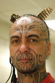
The women wore a skirt belted at the waist, and plaited their hair in long tresses. Sandals were worn by both sexes. Tattooing and head-flattening were occasionally practised, and the face and body were always painted. The Maya, then as now, were noted for personal neatness and frequent use of both cold and hot baths.


Cultural Divisions

Culturally the area is divided into three sections: the northern, central and southern regions. The earliest evidence of the Maya civilization is found in the southern region. At Izapa carvings depict gods that were the precursors of the Classic deities and at Kaminaljuyu glyphs on stelea foreshadow the Maya writing system. The area was clearly influenced by the Olmec.

The central region includes the southern lowlands, from Tabasco in the Northwest to Belize and Guatemala's Motagua River region in the southeast. Here is where the Classic Maya flourished, along the Usumacinta River and throughout the Peten.

The northern region, which encompasses the northern lowlands, was populated by the Maya in the Late Classic period, when influence from central Mexico created a hybrid Maya/Toltec culture, and was home to the Maya well into the Post-Classic period.


Government

Under the ancient system, the Maya Government was an hereditary absolute monarchy, with a close union of the spiritual and temporal elements, the hereditary high priest, who was also king of the sacred city of Izamal, being consulted by the monarch on all important matters, besides having the care of ritual and ceremonials.

On public occasions the king appeared dressed in flowing white robes, decorated with gold and precious stones, wearing on his head a golden circlet decorated with the beautiful quetzal plumes reserved for royalty, and borne upon a canopied palanquin.

The provincial governors were nobles of the four royal families, and were supreme within their own governments.

The rulers of towns and villages formed a lower order of nobility, not of royal blood. The king usually acted on the advice of a council of lords and priests.

The lords alone were military commanders, and each lord and inferior official had for his support the produce of a certain portion of land which was cultivated in common by the people.

They received no salary, and each was responsible for the maintenance of the poor and helpless of his district. The lower priesthood was not hereditary, but was appointed through the high priest. There was also a female priesthood, or vestal order, whose head was a princess of royal blood.

The plebeians were farmers, artisans, or merchants; they paid taxes and military service, and each had his interest in the common land as well as his individual portion, which descended in the family and could not be alienated.

Slaves also existed, the slaves being chiefly prisoners of war and their children, the latter of whom could become freemen by putting a new piece of unoccupied ground under cultivation.

Society was organized upon the clan system, with descent in the male line, the chiefs being rather custodians for the tribe than owners, and having no power to alienate the tribal lands. Game, fish, and the salt marshes were free to all, with a certain portion to the lords.

Taxes were paid in kind through authorized collectors. On the death of the owner, the property was divided equally among his nearest male heirs.

The more important cases were tried by a royal council presided over by the king, and lesser cases by the provincial rulers or local judges, according to their importance, usually with the assistance of a council and with an advocate for the defense.

Crimes were punished with death - frequently by throwing over a precipice - enslavement, fines, or rarely, by imprisonment.

The code was merciful, and even murder could sometimes be compounded by a fine.

Children were subject to parents until of an age to marry, which for boys was about twenty.

The children of the common people were trained only in the occupation of their parents, but those of the nobility were highly educated, under the care of the priests, in writing, music, history, war, and religion.

The daughters of nobles were strictly secluded, and the older boys in each village lived and slept apart in a public building. Birthdays and other anniversaries were the occasions of family feasts.


Marriage

Marriage between persons of the same gender was forbidden, and those who violated this law were regarded as outcasts.

Marriage within certain other degrees of relationship - as with the sister of a deceased wife, or with a mother's sister - was also prohibited.

Polygamy was unknown, but concubinage was permitted, and divorce was easy. Marriages were performed by the priests, with much ceremonial rejoicing, and preceded by a solemn confession and a baptismal rite, known as the "rebirth", without which there could be no marriage.

No one could marry out of his own rank or without the consent of the chief of the district.


Military

The Mayans were expert and determined warriors, using the bow and arrow, the dart with throwing-stick, the wooden sword edged with flints, the lance, sling, copper axe, shield of reeds, and protective armour of heavy quilted cotton.

They understood military tactics and signalling with drum and whistle, and knew how to build barricades and dig trenches. Noble prisoners were usually sacrificed to the gods, while those of ordinary rank became slaves.

Their object in war was rather to make prisoners than to kill.


Mining

As the peninsula had no mines, the Maya were without iron or any metal excepting a few copper utensils and gold ornaments imported from other countries.

Their tools were almost entirely of flint or other stone, even for the most intricate monumental carving.

For household purposes they used clay pottery, dishes of shell, or gourds. Their pottery was of notable excellence, as were also their weaving, dyeing, and feather work.

Along the coast they had wooden dugout canoes capable of holding fifty persons.

Pyramids of Maya Civilization

Pyramids of Mesoamerica
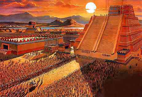
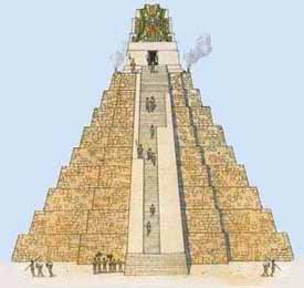
Most Ancient Mesoamerican civilisations built pyramid-shaped structures. These were also usually step pyramids, with temples on top - more akin to the ziggurats of Mesopotamia than to the pyramids of Ancient Egypt. The Mesoamerican region's largest pyramid by volume - indeed, the largest in the world by volume - is the Great Pyramid of Cholula, in the Mexican state of Puebla.

Most Ancient Mesoamerican civilizations built pyramid-shaped structures. These were also usually step pyramids, with temples on top - more akin to the ziggurats of Mesopotamia than to the pyramids of Ancient Egypt. The Mesoamerican region's largest pyramid by volume - indeed, the largest in the world by volume - is the Great Pyramid of Cholula, in the Mexican state of Puebla.

Pyramid of Cholula
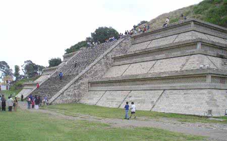

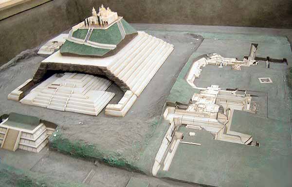
The Great Pyramid of Cholula or Tlachihualtepetl (Nahuatl for "artificial mountain") is a huge complex located in Cholula, Puebla, Mexico. It is the world's largest monument and largest Pre-Columbian pyramid by volume.

The temple-pyramid complex was built over many dozens of generations, from the 2nd century BC to the early 16th century, and was dedicated to the deity Quetzalcoatl. It has a base of 450 by 450 m (1476x1476 ft) and a height of 66 m (217 ft). According to the Guinness Book of Records, it is in fact the largest pyramid as well as the largest monument ever constructed anywhere in the world, with a total volume estimated at 4.45 million m, almost one third larger than that of the Great Pyramid of Giza in Egypt. The Aztecs believed that Xelhua built the Great Pyramid of Cholula.

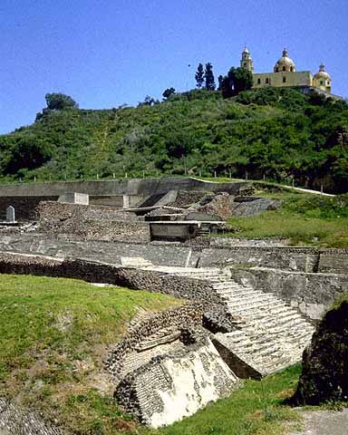
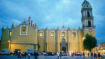
Today the pyramid at first appears to be a natural hill surmounted by a church. This is the Iglesia de Nuestra Señora de los Remedios (Church of Our Lady of the Remedies), also known as the Santuario de la Virgen de los Remedios (Sanctuary of the Virgin of the Remedies), which was built by the Spanish in colonial times (1594) on the site of a pre-Hispanic temple. The church is a major Catholic pilgrimage destination, and the site is also used for the celebration of indigenous rites. Many ancient sites in Latin America are found under modern Catholic holy sites, due to the practice of the Catholic Church repurposing local religious sites.

Because of the historic and religious significance of the church, which is a designated colonial monument, the pyramid as a whole has not been excavated and restored, as have the smaller but better-known pyramids at Teotihuacan. Inside the pyramid are some five miles (8 km) of tunnels excavated by archaeologists.


Aztecs

The Aztecs, a people with a rich mythology and cultural heritage, dominated central Mexico in the 14th, 15th and 16th centuries. Their capital was Tenochtitlan on the shore of Lake Texcoco - the site of modern-day Mexico City. They were linguistically related to, and culturally in awe of, the Toltecs, building styles they adopted and adapted.


Great Pyramid of Tenochtitlan
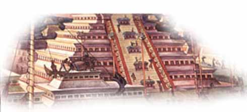
The Great Pyramid or Templo Mayor was the main temple of the Aztec capital of Tenochtitlan (modern Mexico City). The temple rose 60 m (197 ft) above the city's ritual precinct, surmounted by dual shrines to the deities Huitzilopochtli (god of war and sun) and Tlaloc (god of rain and fertility). It was mostly destroyed in 1521 after the conquest of the Aztec empire by the Spanish conquistadores under the leadership of Hernán Cortés. Remains of the lower portions of the temple complex have been discovered by modern archaeologists buried under a portion of modern Mexico City.

Numerous smaller buildings and platforms associated with the temple formed a closely-situated complex around its base. A stucco relief depicting a tzompantli, or "skull rack", decorated one platform leading to the temple. The temple was enlarged several times, and for the last time in 1487. The Great Temple was excavated between 1978 and 1987 in a major project directed by Eduardo Matos Moctezuma.


Xochicalco
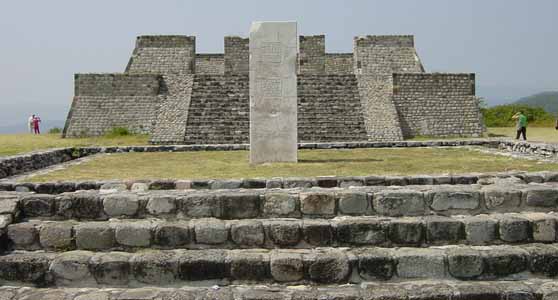
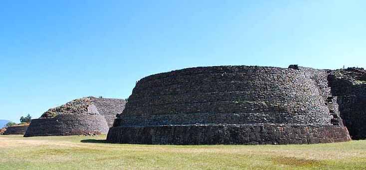
Xochicalco is a pre-Columbian archaeological site in the western part of the Mexican state of Morelos. The name "Xochicalco" means "in the house of Flowers" in the Nahuatl language. The site is located 38 km southwest of Cuernavaca, about 76 miles by road from Mexico City. The site is open to visitors all week, from 10am to 5pm, although access to the observatory is only allowed after noon. The apogee of Xochicalco came after the fall of Teotihuacán and it has been speculated that Xochicalco played a part in the fall of the Teotihuacano empire.

The architecture and iconography shows affinities with Teotihuacan, the Maya area, and the Matlatzinca culture of the Toluca Valley. Today some residents of the villages closest to the ruins of Xochicalco such as Cuentepec and Tetlama in eastern Morelos speak Nahuatl.

The main ceremonial center is atop an artificially leveled hill, with remains of residential structures, mostly unexcavated, on long terraces covering the slopes.

The site was occupied by 200 BC, with the most notable architecture built between about 700 and 1000 AD. At its peak, the city may have had a population of up to 20,000 people.

Of special interest are sculptured reliefs on the sides of some buildings. The Temple of the Feathered Serpent has fine stylized depictions of that deity in a style which includes apparent influences of Teotihuacan and Maya art. It has been speculated that Xochicalco may have had a community of artists from other parts of Mesoamerica.

Other monuments at the site include several other step-pyramid temples, palaces, three ballcourts, sweat-baths, an unusual row of circular altars, and a cave with steps carved down into it. The site also has some free-standing sculptured stelae; others were removed from their original location and are now on display in the INAH museum in Mexico City and at the site museum.

Modern history

The ruins were first described by explorer Antonio Alzate in 1777. Alexander von Humboldt published illustrations and a description of Xochicalco in 1810. Emperor Maximilian of Mexico visited the ruins. The Temple of the Feathered Serpent was restored by Mexican archaeologist Leopoldo Batres in 1910.

Major archaeological excavations and further restorations were done in a project from the 1940s through the 1960s by Eduardo Noguera and César Saenz. Jaime Litvak King also worked at the site. In 1976 archaeologist Kenneth Hirth of Pennsylvania State University began a multi-season fieldwork project in which he mapped the entire site and conducted excavations of houses and obsidian workshops.

In 1988 a large-scale program of excavation of monumental architecture was initiated by Norberto González Crespo and Silvia Garza of the INAH. A new museum was built to house the spectacular finds of this project.

Xochicalco is a UNESCO World Heritage Site and a tourist destination. The site also has a well-stocked museum.


Maya

The

are a people of southern Mexico and northern Central America (Guatemala, Belize, western Honduras, and El Salvador) with some 3,000 years of history. Archaeological evidence shows the Maya started to build ceremonial architecture approximately 3,000 years ago. The earliest monuments consisted of simple burial mounds, the precursors to the spectacular stepped pyramids from the Terminal Pre-classic period and beyond. These pyramids relied on intricate carved stone in order to create a stair-stepped design. Many of these structures featured a top platform upon which a smaller dedicatory building was constructed, associated with a particular Maya deity. Maya pyramid-like structures were also erected to serve as a place of interment for powerful rulers. Maya pyramidic structures occur in a great variety of forms and functions, bounded by regional and period differences.

Chichen Itza

Chichen Itza is a large pre-Columbian archaeological site in Yucatan, Mexico built by the Maya civilization. The Maya name "Chich'en Itza" means "At the mouth of the well of the Itza (people)". Although this was the usual name for the site in pre-Columbian times, it is also referred to in the ancient chronicles as Uucyabnal, meaning "Seven Great Rulers". Chichen" contains many fine stone buildings in various states of preservation; the buildings were formerly used as temples, palaces, stages, markets, baths, and ballcourts.
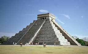

Mayan Pyramid of Kukulkan - The Castle
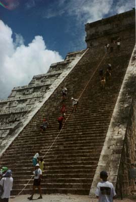

Mayan Pyramid of Kukulkan

Dominating the center of Chichen is the Temple of Kukulcan (the Maya name for Quetzalcoatl), often referred to as (the castle). This step pyramid with a ground plan of square terraces with stairways up each of the 4 sides to the temple on top.
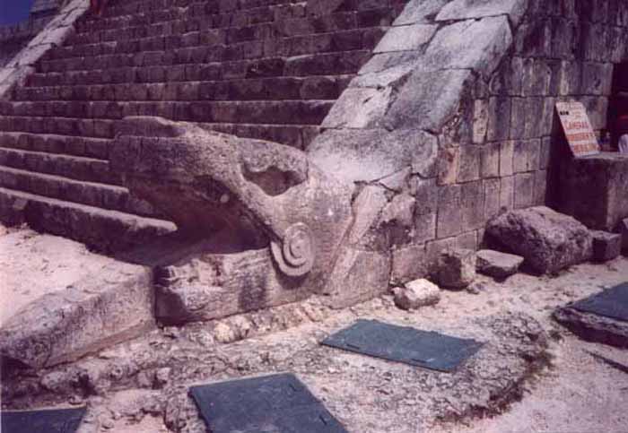
Great sculptures of Plumed Serpents run down the sides of the northern staircase, and are set off by shadows from the corner tiers on the Spring and Fall equinox. It was practice in Mesoamerican cities to periodically build larger and grander temple pyramids atop older ones, and this is one such example.

Thanks to archeologists, a doorway at the base of the north stairway leads to a tunnel, from which one can climb the steps of the earlier version of El Castillo inside the current one, up to the room on the top where you can see King Kukulcan's Jaguar Throne, carved of stone and painted red with jade spots.
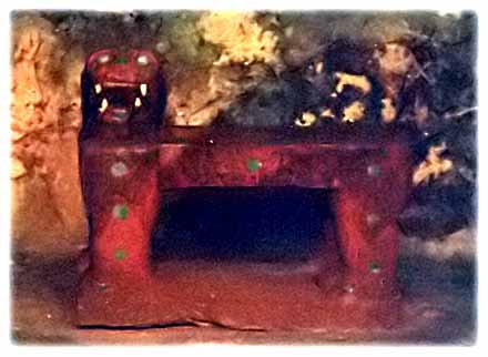
Built into one of the exterior walls of the ballcourt is the Temple of the Jaguar, which features another jaguar throne since this one was not buried for a thousand years, its red paint and jade spots are long since gone. Behind this platform is a walled inscription which depicts a tzompantli (rack of impaled human skulls) in relief.

The Temple of the Warriors
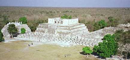
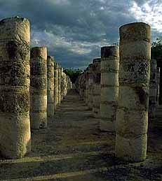
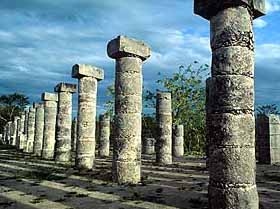
The 'Temple of the Warriors' and its adjacent 'Temple of the Jaguar' are very impressive ruins of the complex. A massive temple structure, surrounded by hundreds of columns is carved with reliefs. The columns continue on into the jungle, that part of the temple still has not been restored.
The Observatory - Carocal
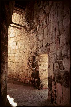
This celestial observatory denotes seasons based on solar alignment at different times of the year.

The Nunnery
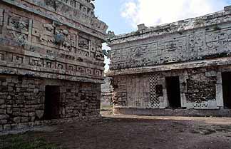
The Mayans were great sportsmen and build huge ballcourts to play their games. The Great Ballcourt of Chichén Itzá is 545 feet long and 225 feet wide overall. It has no vault, no discontinuity between the walls and is totally open to the sky. As we approach a silent sentinel stands guard.
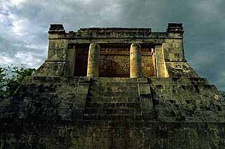

Ball Court Temple

Each end has a raised "temple" area. A whisper from end can be heard clearly at the other end 500 feet away and through the length and breath of the court. The sound waves are unaffected by wind direction or time of day/night. Archaeologists engaged in the reconstruction noted that the sound transmission became stronger and clearer as they proceeded. In 1931 Leopold Stokowski spent 4 days at the site to determine the acoustic principals that could be applied to an open-air concert theater he was designing. Stokowski failed to learn the secret. To this day it has not been explained.

Archaeological study of chirped echo from the Mayan pyramid
of Kukulkan - at Chichen Itza

The massive Kukulcan pyramid called 'El Castillo' - the castle - is roughly at the center of the site. Climbing it is quite a challenge and those who make it are rewarded with a spectacular view of the city and surrounding country side. Inside the pyramid, the corridors and chambers are hot and humid.
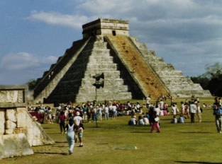
Handclaps evoke chirped echoes from the staircases of the Pyramid of Kukulkan at Chichen Itza. The physics of the chirped echo can be explained quite simply as periodic reflections from stepfaces. The chirped echo sounds much like the primary call of the Mayan sacred bird, the resplendent Quetzal.


Quetzal Bird

This magnificent bird, now near extinction, has for thousands of years represented the 'spirit of the Maya'. Spirits, in many traditions, speak in echoes, lacking a body, just pure spirit.

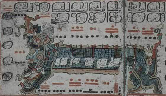
A Mayan glyph from the Dresden Codex makes the connection between the pyramid of Kukulkan and the Quetzal bird. This glyph shows the "sovereign plumed serpent" with a gigantic Quetzal behind him. The Quetzal bird may have represened the spirit of the Maya. Spirits often speak in echoes. It therefore seems most appropriate that the spirit echo of the Pyramid of Kukulkan would speak in the echo-voice of the Quetzal.

Today the Quetzal plays an important part in modern Mayan culture. Many modern Maya live in Guatemala, and in the Mexican States of Chiapas and Quintan Roo. The Quetzal is the unit of currency in Guatemala. The Guatemalan government issues a prestigious award named "The Order of the Quetzal." Could the Maya have intentionally coded the sound of their sacred bird into the pyramid architecture?

In the millenium since this pyramid was built, though the plaster has eroded from the limestone staircases, the sound is still recognizable.
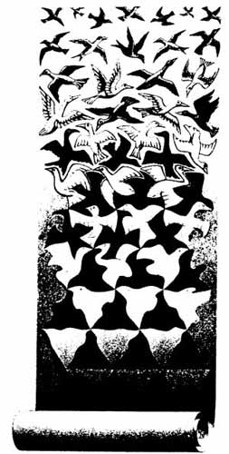


Language of the Birds - God Language


Altun Ha

Altun Ha is the name given ruins of an ancient Maya city in Belize, located in the Belize District about 30 miles (50 km) north of Belize City and about 6 miles (10 km) west of the shore of the Caribbean Sea."Altun Ha" is a modern name in the Maya language, coined by translating the name of the nearby village of Rockstone Pond. The ancient name is at present unknown.The largest of Altun Ha's temple-pyramids, the "Temple of the Masonry Altars", is 54 feet (16 m) high. A drawing of this structure is the logo of Belize's leading brand of beer, "Belikin".

The site covers an area of about 5 miles (8 km) square. The central square mile of the site has remains of some 500 structures.Archeological investigations show that Altun Ha was occupied by 200 BC. The bulk of construction was from the Maya Classic era, c. 200 to 900 AD, when the site may have had a population of about 10,000 people. About 900 there was some looting of elite tombs of the site, which some think is suggestive of a revolt against the site's rulers.

The site remained populated for about another century after that, but with no new major ceremonial or elite architecture built during that time. After this the population dwindled, with a moderate surge of reoccupation in the 12th century before declining again to a small agricultural village.

The ruins of the ancient structures had their stones reused for residential construction of the agricultural village of Rockstone Pond in modern times, but the ancient site did not come to the attention of archeologists until 1963, when the existence of a sizable ancient site was recognized from the air by pilot and amateur Mayanist Hal Ball.

Starting in 1965 an archeological team lead by Dr. David Pendergast of the Royal Ontario Museum began extensive excavations and restorations of the site, which continued through 1970. One of the most spectacular discoveries is a large (almost 10 pounds or 5 kilograms) piece of jade elaborately carved into an image of the head of the Maya Sun God, Kinich Ahau. This jade head is considered one of the national treasures of Belize. A road connects Altun Ha to Belize's Northern Highway, and the site is accessible for tourism.


Calakmul
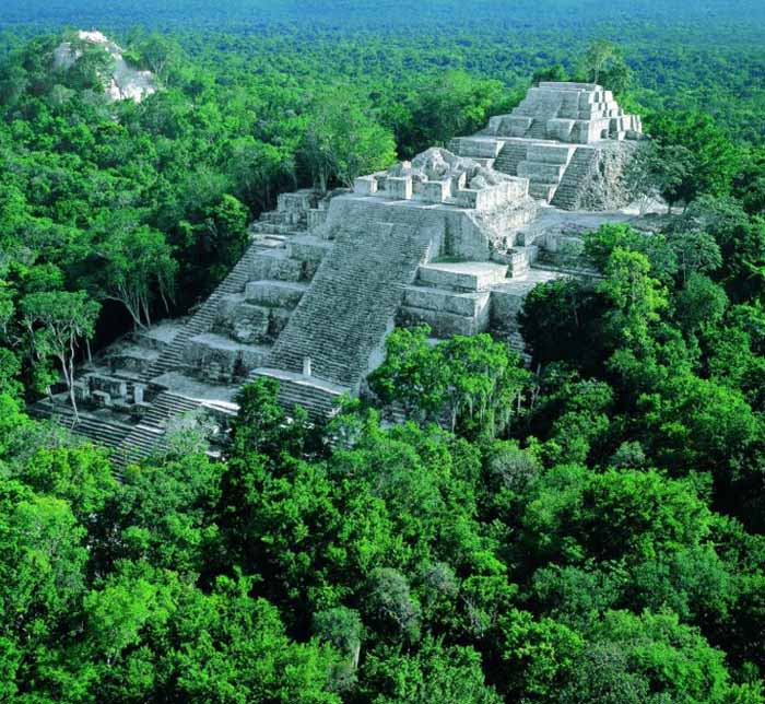
Calakmul is the name of both a municipality and a major archeological site in the Mexican state of Campeche, in the central part of the Yucatán Peninsula.

Calakmul (also Kalakmul and other less frequent variants) is also the name given to site of one of the largest ancient Maya cities ever uncovered. It is located in the 1,800,000 acre Calakmul Biosphere Reserve, deep in the jungles of the Petén, 30 km from the Guatemalan border.

First discovered from the air by biologist Cyrus L. Lundell of the Mexican Exploitation Chicle Company on December 29, 1931, the find was reported to Sylvanus G. Morley of the Carnegie Institute at Chichen Itza in March 1932. According to Lundell, who named the site, "In Maya, 'ca' means 'two', 'lak' means 'adjacent', and 'mul' signifies any artificial mound or pyramid, so 'Calakmul' is the 'City of the Two Adjacent Pyramids'."

Calakmul was the major seat of power of the Kaan or "Kingdom of the Snake", which first arose further north but built Calakmul into a Late Classic Era superpower ally of Caracol and rival to Tikal. A series of 11 painted vessels, dubbed Dynastic Vases, describe the ascensions of the Kaan rulers, including ancestral and legendary figures.

Calakmul probably supported a population of over 50,000, and so far more than 6,250 structures have been discovered in an area of up to 70 square kilometers with a substantial northern wall and a series of water management features (Calakmul's reservoirs include the largest in the Maya world) delineating a dense core of 22 square kilometers. Calakmul's 45 meter pyramid "Structure 2" is the largest Classic Era Maya temple platform known. Many of the city's monuments and structures are constructed of chalky local limestone, which has made interpretation of the site difficult.

After a long period of inactivity following Morely's 1932 expedition, the city was explored by William Folan between 1984 and 1994, and is now the subject of a large-scale project of the National Institute of Anthropology and History (INAH) under Ramon Carrasco.


Caracol
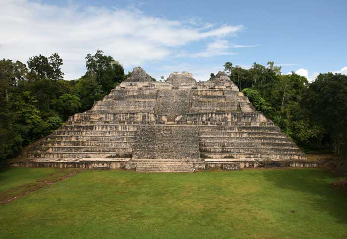
Caracol or El Caracol is the name given to a large ancient Maya site located in the Cayo District of the nation of Belize. Caracol is about 25 miles south of Xunantunich and San Ignacio Cayo, at an elevation of 1500 feet (460 m) above sea-level, in the foothills of the Maya Mountains. The name is Spanish for "The Snail"; the ancient Maya name may have been Oxhuitza. It is known as such due to the large numbers of these creatures found at the site on its visitation by A.H. Anderson, the then chief archaeologist to British Honduras, after its discovery in 1937 by Rosa Mai, a mahogany logger. The site was occupied as early as 1200 BCE, but had its greatest period of construction in the Maya Classic period, with over 40 monuments dated between 485CE to 889CE which record the dynastic sequence of the rulers.

Ancient Caracol was one of the largest ancient Maya cities, covering some 65 square miles (168 kms) with an estimated peak population of about 120,000, or possibly as many as 180,000 people. One monument here records a military victory over the army of Tikal in 562CE, where Caracol's Lord Water is shown to have captured and sacrificed Tikal's Double Bird. This event is seemingly concurrent with archaeological and epigraphic evidence indicating the beginning of the Tikal Mid-Classic Hiatus, when a seeming decline in Tikal's population, a cessation of monument building, and the destruction of certain monuments in the Great Plaza occurred as Caracol's population and urban development seemingly skyrocketed.

The site was first noted and documented in archaeological terms in 1937. More extensive explorations and documention of the site was undertaken by the University of Pennsylvania in 1951 and 1953. A project of archaeological excavations and restorations of the ancient structures at Caracol started in 1985 and is ongoing. The project is currently directed by Drs. Arlen and Diane Chase of the University of Central Florida in Orlando. The site is maintained by residential wardens from the Belize Institute of Archaeology, a sub-division of the National Institute of Culture and History, a government-run agency.

The site currently accommodates an average of 15-20 tourists per day, with greater numbers during the peak season around Easter. A museum to hold the large monuments found at the site is currently being constructed. A visitor center is already at the site, and recent developments include new directional and informational signs and a house for the residential staff. The only road Caracol may be accessed by is paved for the last ten miles and leads to the Western Highway between San Ignacio and Belmopan and to Santa Elena.

Caana ("sky-palace") is the largest building at Caracol. It remains one of the largest man-made structures in Belize.


Palenque
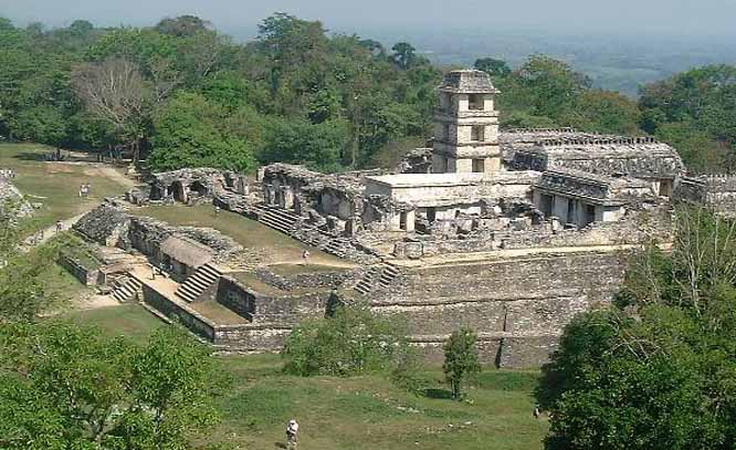
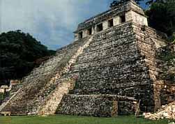
Palenque is a Maya archeological site near the Usumacinta River in the Mexican state of Chiapas. It is a medium-sized site, much smaller than such huge sites as Tikal or Copán, but it contains some of the finest architecture, sculpture, roof comb and bas-relief carvings the Maya produced.

The site was already long abandoned when the Spanish arrived in Chiapas. The first European to visit the ruins and publish an account was Father Pedro Lorenzo de la Nada in 1567; at the time the local Chol Maya called it Otolum meaning "Land with strong houses", de la Nada roughly translated this into Spanish to give the site the name "Palenque", meaning "fortification". Palenque also became the name for the town (Santo Domingo del Palenque) which was built over some peripheral ruins down in the valley from the main ceremonial center of the ancient city.

An ancient name for the city was Lakam Ha, which translates as "Big Water" or "Wide Water", for the numerous springs and wide cascades that are found within the site. Palenque was the capital of the important classic-age Mayan city-state of B'aakal (Bone).

The Maya Classic City

While the site was occupied by the middle Pre-Classic, it did not gain importance until several hundred years later. By 600 the first of the famous structures now visible were being constructed. Situated in the western reaches of Maya territory, on the edge of the southern highlands, B'aakal was a large and vital center of Maya civilization from the 5th century AD to the 9th century.

The B'aakal state had a chequered career. Its original dynasts were perhaps Olmec. Politically, the city experienced diverse fortunes, being disastrously defeated by Kalakmul in 599 and again in 611.

Nevertheless, B'aakal produced what is arguably the best-known Maya Ajaw (king or lord), Pacal the Great, who ruled from 615 to 683, and left one of the most magnificent tomb-works of ancient Mesoamerica, beneath the Temple of Inscriptions. This is a grand temple atop a step pyramid dedicated in 692; inside is an elaborate, long hieroglyphic text carved in stone detailing the city's ruling dynasty and the exploits of Pacal the Great.

A stone slab in the floor could be lifted up, revealing a passageway (filled in shortly before the city's abandonment and reopened by archeologists) to a long interior stairway leading back down to ground level and the shrine/tomb of the semi-divine Pacal. Over his crypt is an elaborate stone showing him falling into the underworld, and taking the guise of one of the Maya Hero Twins in the Popul Vuh who defeated the lords of the underworld to achieve immortality.

Other important structures at Palenque include:

  • The Palace, actually a complex of several connected and adjacent buildings and courtyards built up over several generations on a wide artificial terrace. The Palace houses many fine sculptures and bas-relief carvings in addition to the distinctive four-story tower.
  • The Temple of the Cross, Temple of the Sun, and Temple of the Foliated Cross. This is a set of graceful temples atop step pyramids, each with an elaborately carved relief in the inner chamber. They commemorate the succession of King Chan Bahlum II to the throne after the death of Pacal the Great, and show the late king passing on his greatness to his successor. These temples were named by early explorers; the cross-like images in two of the reliefs actually depict the tree of creation at the center of the world in Maya mythology.
  • The Aqueduct constructed with great stone blocks with a three-meter-high vault to make the Otulum River flow underneath the floor of Palenque's main plaza.
  • The Temple of The Lion at a distance of some 200 meters south of the main group of temples; its name came from the elaborate bas-relief carving of a king seated on a throne in the form of a jaguar.
  • Structure XII with a bas-relief carving of the God of Death.
  • Temple of the Count another elegant Classic Palenque temple, which got its name from the fact that early explorer Jean Frederic Waldeck lived in the building for some time, and Waldeck claimed to be a Count.

The site also has a number of other temples, tombs, and elite residences, some a good distance from the center of the site, a court for playing the Mesoamerican Ballgame, and an interesting stone bridge over the Otulum River some distance below the Aquaduct.


Tikal
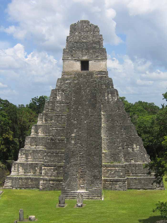
Tikal is the largest of the ancient ruined cities of the Maya civilization. It is located in the El Peten department of Guatemala. The ruins lay on lowland rainforest. Conspicuous trees at the Tikal park include gigantic ceiba (Ceiba pentandra) the sacred tree of the Maya; tropical cedar (Cedrela odorata), and mahogany (Swietenia). Regarding the fauna, agouti, spider monkeys, howler monkeys, ocellated turkeys, guans, toucans, green parrots and leaf-cutting ants can be seen there regularly. Jaguars and coatis are said to roam in the park.

Tikal was one of the major cultural and population centers of the Maya civilization. Monumental architecture was built here as early as the 4th century BC. The city was at its height in the Maya Classic Period, approximately 200 AD to 850 AD, after which no new major monuments were built, some of the palaces of the elite were burned, and the population gradually declined until the site was abandoned by the end of the 10th century.

The name "Tikal" means "Place of Voices" or "Place of Tongues" in Maya, which may be an ancient name for the city, although the ancient hieroglyphs usually refer to it as Mutal or Yax Mutal, meaning "Green Bundle", and perhaps metaphorically "First Prophecy".

Scholars estimate that at its peak its population was between 100,000 -- 200,000.

The site presents hundreds of significant ancient buildings, only a fraction of which have been excavated in the decades of archeological work.

The most prominent surviving buildings include six very large step pyramids supporting temples on their tops. They were numbered geographically by early explorers. They were built during the city's height from the late 7th and early 9th century. Temple I was built around 695; Temple III in 810; The largest, Temple-pyramid IV, some 72 meters (230 feet) high, was dedicated in 720. Temple V is from about 750.

Temple VI was dedicated in 766.The ancient city also has the remains of royal palaces, in addition to a number of smaller pyramids, palaces, residences, and inscribed stone monuments. There is even a building which seemed to have been a jail, originally with wooden bars across the windows and doors. There are also several courts for playing the Mesoamerican ballgame.

The residential area of Tikal covers an estimated 60 square km (23 square miles), much of which has not yet been cleared or excavated.

Some of the pyramids of Tikal are over 60 meters high (200 feet).A huge set of earthworks has been discovered ringing Tikal with a 6 meter wide trench behind a rampart. Only some 9km of it has been mapped; it may have enclosed an area of some 125 km square.

Recently, a project exploring the earthworks has shown that the scale of the earthworks is highly variable and that in many places it is inconsequential as a defensive feature. In addition, some parts of the earthwork were integrated into a canal system. The earthwork of Tikal varies significantly in coverage from what was originally proposed and it is much more complex and multifaceted than originally thought.


Uxmal
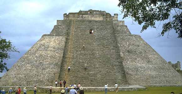
Uxmal is a large Pre-Columbian ruined city of the Maya civilization in the state of Yucatán, Mexico.

Uxmal is pronounced "Oosh-mahl". The place name is Pre-Columbian and it is usually assumed to be an archaic Maya language phrase meaning "Built Three Times", although some scholars of the Maya language dispute this derivation.

Even before the restoration work Uxmal was in better condition than many other Maya sites thanks to being unusually well built. Much was built with well cut stones not relying on plaster to hold the building together. The Maya architecture here is considered matched only by that of Palenque in elegance and beauty. The Puuc style of Maya architecture predominates. Thanks to its good state of preservation, it is one of the few Maya cities where the casual visitor can get a good idea of how the entire ceremonial center looked in ancient times.

Some of the more noteworthy buildings.
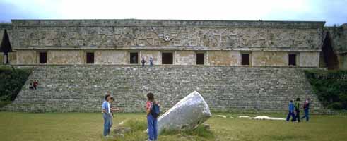

The Governor's Palace, a long low building atop a huge platform,
with the longest facades in Pre-Columbian Mesoamerica.


The Adivino or "Pyramid of the Magician", a fine pyramid temple unusual in several ways. The layers of the step pyramid are oval, rather than the usual rectangular or square shape. It was a common practice in Mesoamerica to build new temple pyramids atop older ones, but here a newer pyramid was built centered slightly to the east of the older pyramid, so that on the west side the temple atop the old pyramid is preserved, with the newer temple above it.
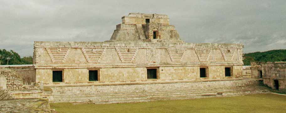

The Nunnery Quadrangle (a nickname given to it by the Spanish; it was a government palace) is the finest of Uxmal's several fine quadrangles of long buildings with elaborately carved facades on both the inside and outside faces.

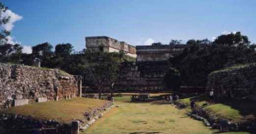
A large Ballcourt for playing the Mesoamerican ballgame, which an
inscription there informs us was dedicated in 901 by Chan Chak K'ak'nal-Ahau.

A number of other temple-pyramids, quadrangles, and other monuments, some of significant size, and in varying states of preservation, are also at Uxmal. The majority of hieroglyphic inscriptions were on a series of stone stelae unusually grouped together on a single platform. The stelae depict the ancient rulers of the city, and they show signs that they were deliberately broken and toppled in antiquity; some were re-erected and repaired.A further suggestion of possible war or battle is found in the remains of a wall which encircled most of the central ceremonial center. A large raised stone pedestrian causeway links Uxmal with the site of Kabah, some 18 km to the south.

Modern history of the ruins

The site, located not far from Mérida beside a road to Campeche, has attracted many visitors since the time of Mexico's independence. The first detailed account of the ruins was published by Jean Frederic Waldeck in 1838. John Lloyd Stephens and Frederick Catherwood made two extended visits to Uxmal in the early 1840s, with architect/draftsman Catherwood reportedly making so many plans and drawings that they could be used to construct a duplicate of the ancient city (unfortunately most of the drawings are lost).

Desire Charnay took a series of photographs of Uxmal in 1860. Some three years later Empress Carlota of Mexico visited Uxmal; in preparation for her visit local authorities had some statues and architectural elements depicting phallic themes removed from the ancient facades.

Sylvanus G. Morley made a map of the site in 1909 which included some previously overlooked buildings. The Mexican' governments first project to consolidate some of the structures from risk of collapse or further decay came in 1927.

In 1930 Frans Blom led a Tulane University expedition to the site which included making plaster casts of the façades of the "Nunnery Quadrangle"; using these casts a replica of the Quadrangle was constructed and displayed at the 1933 World's Fair in Chicago, Illinois.

In 1936 a further Mexican government repair and consolidation program was begun under José Erosa Peniche.

Queen Elizabeth II of the United Kingdom visited on 27 February of 1975 for the inaguration of the site's sound & light show; when the presentation reached the point where the sound system played the Maya prayer to Chaac, a sudden torrential downpour fell upon the gathered dignitaries, despite the fact that it was the middle of the dry season. Two hotels and a small museum have been built within the remains of the ancient city.


Tzintzuntzan
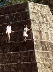
Tzintzuntzan is a city in the state of Michoacan, Mexico. It stands on the eastern shore of Lake Pátzcuaro, about 15 km north of the city of Patzcuaro and about 60 km west of state capital Morelia, and at some 2050 m above sea level. It serves as the administrative seat for the surrounding municipality of the same name and, in the 2000 census, reported a population of 3,610 people.

The city was founded in the 13th century by the Native American Tarascan or Purepecha nation, in whose language the name means "Place of the Hummingbirds".

The Pre-Columbian city of Tzintzuntzan covered an area of about 7 kms. The site, which stands on a hillside above the modern town, has the remains of many step pyramids of a design typically used by the P'urepecha in their ritual buildings, known locally as yacatas (by extension, the present-day archaeological site is also known as "Las Yácatas"). The Tzintzuntzan yácatas are of several different shapes, some rectangular, some oval or circular, and others in the distinctive Tarascan "T" shape. The population of the ancient city is estimated to have peaked at somewhere between 25,000 to 35,000 people.

The population of the entire Lake Patzcuaro basin was between 60,000 to 100,000, spread among 91 settlements of which Tzintzuntzan was the largest.

Tzintzuntzan was still the P'urhépecha capital when the Spaniards arrived in 1522. First contact, led by Nuno de Guzman arrived in 1529, Chieftain Tangaxuan II was burned alive and the city largely dismantled to provide stones for Roman Catholic temples and civic buildings, most notably the large 16th century Franciscan Monastery of Santa Ana. Following the disgrace and recall of Nuño de Guzmán, Vasco de Quiroga was sent to the region, and Tzintzuntzán served as the headquarters of Spanish power in the area until the bishopric was relocated to Pátzcuaro in 1540.

The modern town of Tzintzuntzan is known for the basketry and weaving produced there. The Monastery of Santa Ana is also still standing. It is home to several allegedly miraculous relics and icons and is reputed to have growing on its grounds what were the first olive trees to be planted in America.

Tzintzuntzan municipality covers a total of 165 kms. In addition to the municipal seat, the other main settlements are Ihuatzio, Cucuchuchu, and Los Corrales. In 1995, the municipality's total population numbered some 12,500, of whom 2550 spoke a Native American language (principally Purépecha and Ixcatec).
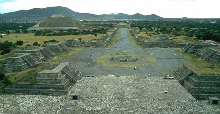


Pyramids of the Sun and The Moon at Teotihuanos

Comparative Geometric Analysisof the Heights and Bases of the Great Pyramid of Khufu and the Pyramid of the Sun at Teotihuacan ...


Tula
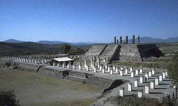
Tula is a town of 28,432 (2005 census) in the southwestern part of the state of Hidalgo in central Mexico, some 100 km to the north-northwest of Mexico City. The modern town is known as Tula de Allende; also a state municipality that covers part of the southeastern portion of the Pre-Columbian city. The present-day municipality has a population of 93,296 and an areal extent of 305.8 kms (118.07 sq mi), which includes numerous smaller outlying towns, the largest of which are El Llano, San Marcos, and San Miguel Vindho.

Nearby are the remains of the ancient capital city of the Toltecs, also known as "Tula" or as "Tollan". Usually identified as the Toltec capital around 980 CE, the city was destroyed at some time between 1168 or 1179.

The site is at and around the junction of two rivers, the Río Rosas and the Río Tula. The two largest clusters of grand ceremonial architecture are nicknamed "Tula Grande" (the most visited by tourists) and "Tula Chico". Remains of other buildings extend for some distance in all directions. In the residential areas streets were laid out in a grid pattern.

The city was the largest in central Mexico in the 9th and 10th centuries, covering an area of some 12 kms with a population of at least some 30,000, possibly significantly more. While it might have been the largest city in Mesoamerica at the time, some Maya sites in the Yucatán may have rivaled its population during this period.

Distinctive Toltec features here include terraced pyramids, colonnaded buildings, and relief sculptures, including the characteristic chacmools, reclining figures that may have been avatars of the rain god, Tlaloc. There are two large courts for playing the Mesoamerican ballgame. Some of the architecture is similar to that at Chichen Itza.

The site was extensively looted in Aztec times, with much of the artwork and sculpture carted off. The first scholarly description of the ruins was made by Antonio García Cubas of the Mexican Society of Geography and History in 1873. The first archaeological excavations were conducted in the 1880s by French antiquarian Désiré Charnay. A twenty year archaeological project under Jorge Acosta of Mexico's National Institute of Anthropology and History (INAH) began in 1940. In the 1970s further excavations and restorations of some structures were conducted by INAH and the University of Missouri­Columbia.

Parts of the site are open for tourist visits, and Tula has a small museum.


एल Tajin
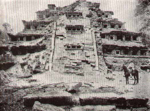
El Tajín is a Pre-Columbian archaeological site near the city of Papantla, in the state of Veracruz, Mexico.

Construction of ceremonial buildings at El Tajín began about the 1st century. Early classic Tajín shows influence of Teotihuacan; early postclassic shows considerable Toltec influence. Construction continued to about the start of the 13th century, at which time the city was conquered and burned by Chichimec invaders. The site continued to be occupied after this by a smaller population, but no new large construction projects were initiated. The site was completely abandoned with the arrival of the Spanish conquerors in the early 16th century.

The abandoned site was overgrown with forest. In 1785 engineer Diego Ruiz visited the site and published the first description of the site. In the early 19th century it was visited by Guillermo Dupaix, Alexander von Humboldt, and Carlos Nebel, who published additional accounts.The first archeological excavation of the site was made by Jose Garcia Payon from 1943 through 1963. The Mexican Institute of Anthropology & History has made additional restoration to buildings at the site since the 1980s.
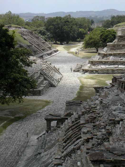
The ceremonial center of the site is covers only about 1 km square, but there are mostly unexcavated remains of subsidiary buildings extending for a considerable distance beyond.The ceremonial center has number of temple-pyramids, palaces, and several courts for playing the Mesoamerican ballgame.

The site's most famous building is the Pyramid of the Niches. The step pyramid of 6 terraces is some 60 feet high. The size is only medium as Mesoamerican pyramids go, but the architecture creates a striking and visually pleasing effect. The terraces are of well cut stone forming a series of 365 niches. A staircase rises up the pyramid's east side. Originally the pyramid was topped by a temple, but little remains of this.

A number of the buildings have carved relief on them, and the site also has some free standing stone stelae. Many of the sculptures depict the ritual ballgame and ritual bloodletting by the elite. The site is now a tourism destination, has a moderate sized museum.


Monte Alban
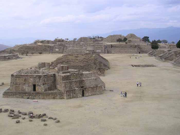
Monte Albán is a large archaeological site in the state of Oaxaca, Mexico, located at 17.02° N 96.45° W, elevation 1941 meters.The name "Monte Albán" means "White Mountain" in the Spanish language; the Zapotec name was Danipaguache, meaning "Sacred Mountain of Life".

The Aztecs knew it as Ocelotepec, or "Jaguar Mountain".

This sacred Mesoamerican city is on an artificially flattened mountain top some 400 meters above the city of

Monte Albán was built over a period of over 2,000 years, starting about 900 BCE, by the Zapotec people. The early art shows Olmec influence. The most impressive building period was during the Mesoamerican Classic era, from about 550 CE to 1000 CE.

|About 1300 CE, the Zapotec were driven out of the site and surrounding area by the Mixtec people. The Mixtec made further additions to Monte Albán until they in turn were conquered by the Spanish Conquistadores in 1521, at which time Monte Albán was abandoned.

Monte Albán has many step-pyramids, temples, elite tombs, and a court for playing the Mesoamerican ballgame. There are also free-standing sculptured stelae, and large bas-relief carved panels in some of the buildings.

The oldest carved stones at the site are the so-called "Danzantes" (literally, dancers), featuring drawings of people in contorted and twisted poses. Although the notion that they depict a dance is generally discredited now, there is still little agreement on what exactly the figures represent, but many archaeologists think that the "dancers" are representations of tortured war prisoners. Some of the original stones can be viewed in the museum at the site.

Building J (the arrowhead-shaped building shown in the top picture) has also invited much speculation, due to its unusual shape and orientation. Alfonso Caso suggested it was an astrological observatory, though other theories have been offered.